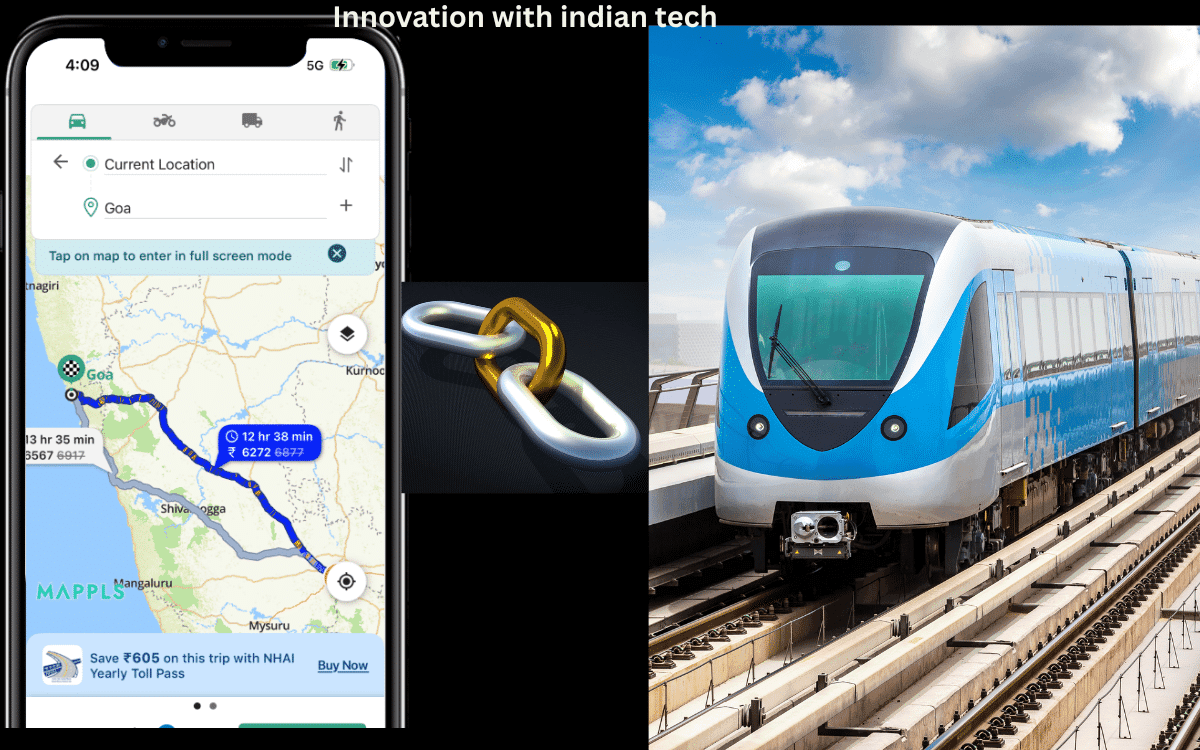
🌐 MapmyIndia’s Mappls App Now Speaks 9 Indian Languages — Making Navigation Truly Local
Delhi-based MapmyIndia, a leader in digital mapping and geospatial technology, has taken a major step toward enhancing accessibility by introducing nine regional Indian languages on its flagship Mappls App. This move aims to make digital navigation more inclusive and user-friendly for millions across India.
🗺️ Mappls App Now Supports 9 Regional Languages
The Mappls App now supports Hindi, Tamil, Telugu, Bengali, Marathi, Kannada, Punjabi, Malayalam, and Gujarati, ensuring users can access maps, navigation, and directions in their preferred language — no matter where they are in the country.
The announcement was made by Hitesh Kumar S. Makwana, IAS, the Surveyor General of India, during an event in New Delhi. The new update is designed to provide a seamless navigation experience to more than 30 million users, reflecting MapmyIndia’s commitment to local accessibility and digital empowerment.
💬 Empowering Users Through Language Diversity
Rakesh Verma, Co-founder and CMD of MapmyIndia, highlighted that this multilingual feature aligns with the government’s vision of “Atmanirbhar Sarvottam Bharat.” He emphasized that language inclusivity is key to bridging the gap between advanced technology and everyday users.
“Our goal is to make navigation easy and relatable for every Indian, regardless of their language or region,” Verma said.
This initiative reinforces MapmyIndia’s commitment to innovation, localization, and inclusivity, making it one of the most India-centric navigation apps in the market.
🚗 Advanced Features and Nationwide Coverage
Built on MapmyIndia’s industry-leading digital maps, the Mappls app covers an impressive 6.6 million km of roads, 7,900 towns, 637,000 villages, and more than 30 million businesses across India. It also includes 550 million geo-referenced images for an unmatched mapping experience.
Users can benefit from turn-by-turn navigation, voice guidance, and localized search features — all now available in nine regional languages. The app also offers traffic alerts, trip cost estimates, and real-time updates, covering 99.9% of India’s road network.
🔍 Innovating Beyond Maps
Beyond traditional 2D maps, MapmyIndia is pushing the boundaries with 3D landmarks, 4D real-time mapping, and HD high-accuracy visuals. Its RealView 360° geo-tagged panoramas aim to create an AI-powered digital twin of the real world, enhancing India’s geospatial infrastructure.
Makwana praised the company’s efforts, saying,
“MapmyIndia’s initiative is a strong example of using geospatial technology to simplify life for the common man and strengthen India’s digital ecosystem.”
This update also marks a major milestone for iOS users, making Mappls the only navigation platform in India to offer multi-language support across nine Indian languages.
Recently, MapmyIndia expanded its footprint further by acquiring a 9.37% stake in Kanpur-based SimDaaS Autonomy, a startup focused on autonomous mapping technology — reinforcing its leadership in the Indian geospatial sector.